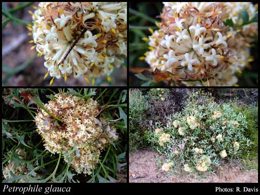
- Reference
- Fl.Australia 16:475 (1995)
- Conservation Code
- Not threatened
- Naturalised Status
- Native to Western Australia
- Name Status
- Current
Erect or low growing, dense shrub, 0.3-1.2(-2) m high. Fl. yellow/cream-white, Aug to Nov. Laterite, sandy gravelly soils, sand. Lateritic ridges, sandplains.


Scientific Description
Shrubs, 0.5-1 m high; branchlets glabrous. Leaves alternate, 70-195 mm long, glabrous; lamina flat, twice or more divided, pinnately divided, divided to the midrib, with (4-)7-12(-21) points or lobes; distance from base of leaf to lowest lobe 55-90 mm. Inflorescences not viscid, white, cream or yellow. Perianth 10-21 mm long, hairy, the limb apex hairy all over; pistil 10-20 mm long; pollen presenter fusiform, hairy, 2-3 mm long. Cone with persistent scales, 13-20 mm long. Flowers in August, September, October or November. Occurs in the Eremaean (ER) or South-west (SW) Botanical Province(s), in the Coolgardie (COO), Avon Wheatbelt (AW), Mallee (MAL) or Esperance Plains (ESP) IBRA subregion(s).
Distribution
- IBRA Regions
- Avon Wheatbelt, Coolgardie, Esperance Plains, Mallee.
- IBRA Subregions
- Fitzgerald, Katanning, Merredin, Southern Cross, Western Mallee.
- Local Government Areas (LGAs)
- Bruce Rock, Corrigin, Dumbleyung, Jerramungup, Kent, Kondinin, Kulin, Lake Grace, Narembeen, Narrogin, Ravensthorpe, Wagin, Wickepin, Woodanilling, York.