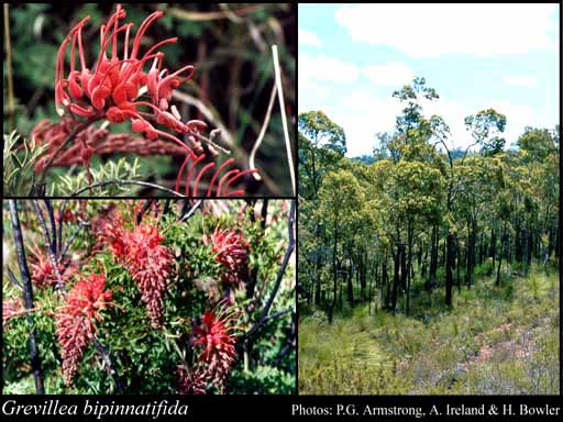
- Reference
- Prodr. Suppl. 23 (1830)
- Conservation Code
- Not threatened
- Naturalised Status
- Native to Western Australia
- Name Status
- Current
Spreading, lignotuberous shrub, 0.2-1 m high. Fl. orange-red, Mar or May to Dec or Jan. Granitic soils, sand, loamy clay, lateritic soils. Granite outcrops, hills, sometimes winter-wet flats.


Distribution
- IBRA Regions
- Avon Wheatbelt, Jarrah Forest, Swan Coastal Plain.
- IBRA Subregions
- Katanning, Northern Jarrah Forest, Perth, Southern Jarrah Forest.
- Local Government Areas (LGAs)
- Armadale, Beverley, Boddington, Bridgetown-Greenbushes, Canning, Capel, Chittering, Collie, Dardanup, Donnybrook-Balingup, Gosnells, Harvey, Kalamunda, Mundaring, Murray, Nannup, Perth, Serpentine-Jarrahdale, Swan, Toodyay, Victoria Plains, Wagin, Wandering, Waroona, West Arthur, Williams, York.